


 30 / 116

3 0
PLUMBING CONNECTION
AUTUMN 2016
T
here can be no argument that the satellite images
generated by Google and the like are invaluable when
it comes to applications like meteorology and regional
planning. But when a detailed inspection of individual
premises is required, satellite images often won’t be able to
provide the requisite resolution.
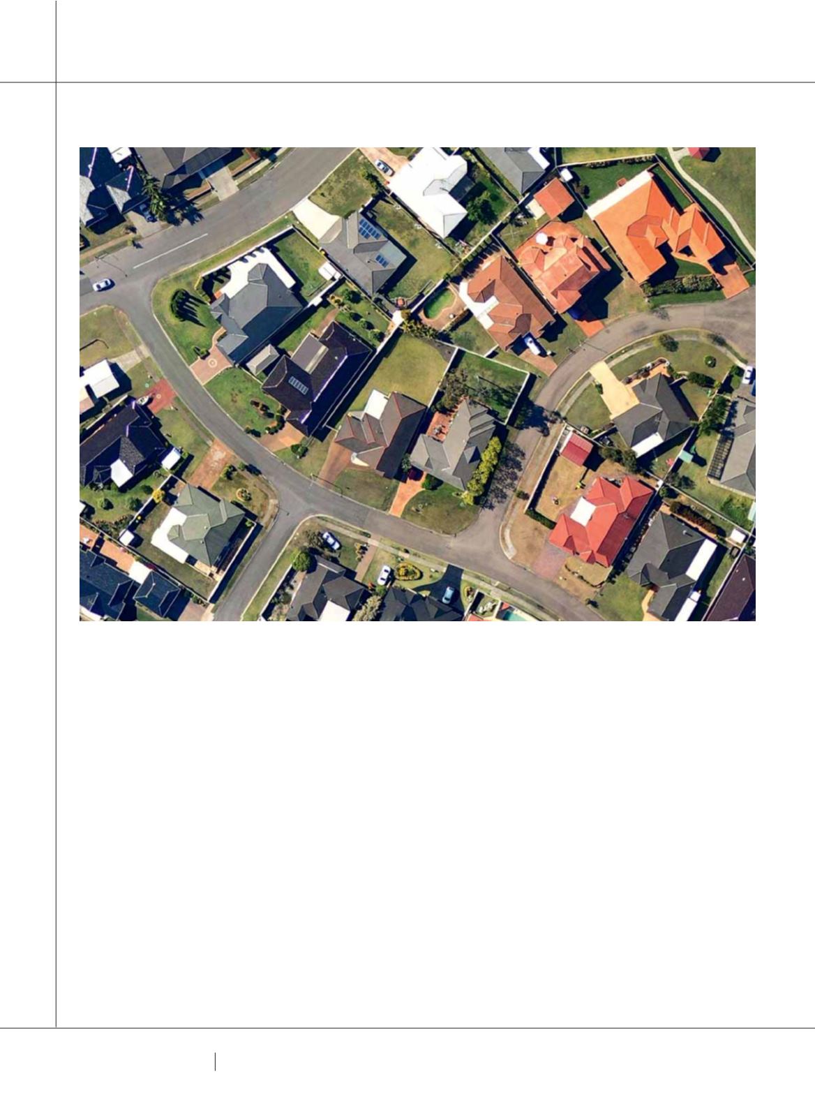
nearmap is an online geospatial mapping and visual
analytics tool that provides companies with high-resolution
imagery captured using aeroplanes. This allows users
access to regularly updated images that contain enough
detail to enable precise measurements and calculations to
be carried out remotely.
“We work with an aviation company that carries our aerial
camera systems within their aircraft, regularly covering 85%
of the Australian population. So in that way we differ from
the likes of Google and Digital Globe that use satellite
technology,” John Biviano Vice President and Managing
Director of nearmap says.
“Our method of capture gives us an advantage because
we’re able to capture at a much higher resolution. We’re
capturing at 7cm per pixel which is 5 times clearer than
satellite images.”
This level of resolution allows users to zoom in and
make detailed analyses without physically visiting the site;
something that is particularly advantageous for industries
like construction, plumbing, roofing and solar.
Central Queensland business Roth Plumbing specialises
in plumbing and roofing for residential, commercial and
industrial properties. The company needed a tool to enhance
productivity and efficiency so it began using nearmap.
“We get requests daily for roof installations, repairs,
redesign, and maintenance jobs. Before quoting for any job,
FRIENDS IN HIGH PLACES
AERIAL IMAGES TAKEN BY AUSTRALIAN COMPANY NEARMAP ARE PROVING TO BE A VALUABLE RESOURCE FOR
BUSINESSES IN A WIDE RANGE OF INDUSTRIES.
JACOB HARRIS
EXPLAINS.
ADVANCED TECHNOLOGY